Forest Monitoring for Action (FORMA)
|
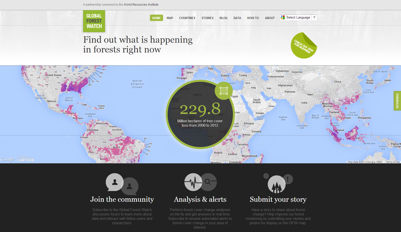
Forest Monitoring for Action (FORMA) uses freely available satellite data to generate rapidly updated online maps of tropical deforestation, providing useful information for local and national forest conservation programs, as well as international efforts to curb greenhouse gas emissions by paying to keep forests intact. Scroll down to view maps for Indonesia from 2000 to the present, or watch the video to see monthly time-lapse images in Riau, Indonesia since the end of 2005. Stay informed about the latest FORMA news – sign up for CGD Climate and Development Updates Overview Forest destruction accounts for about 15% of carbon dioxide emissions, much of it in tropical forests in developing countries. Since these countries also focus on poverty alleviation, their support for forest conservation will be weak as long as forested land has a higher market value in other uses. Under these conditions, many proprietors will continue clearing their forested land unless they are given conservation payments that match or exceed the opportunity cost of the land. This economic insight has led the UN to establish UN-REDD (Reducing Emissions from Deforestation and Forest Degradation in Developing Countries), a program that helps countries prepare for an eventual direct compensation scheme for forest conservation. Although rich countries are willing to pay for forest conservation in developing countries, results must be monitored to ensure that effective measures are identified, and to sustain public support for payments that could reach billions of dollars annually. FORMA is designed to facilitate forest conservation by identifying where - and when - deforestation has occurred on a monthly basis. This information makes it easier to know where to intervene to stop the spread of deforestation, and is intended to complement national forest monitoring programs and local forest conservation efforts. The first phase of the FORMA system shows the spread of deforestation in Indonesia from 2000 to October 2009, producing monthly time-lapse images from December 2005 to October 2009. In future phases, FORMA will be extended to other tropical forest countries. FORMA identifies deforestation by analyzing publicly available satellite data from NASA and other public and academic institutions. In particular, it relies on changes in "greenness" and telltale patterns of fires detected by satellite that are indicative of deforestation. Please visit the methodology page for a more detailed explanation. CGD senior fellow David Wheeler leads the Center's work on climate change and is the chief architect for FORMA. Members of the FORMA team include Daniel Hammer and Robin Kraft. Work on FORMA was made possible by financial support from the Foreign Ministry of Denmark. You may browse the data here in Google Maps. Google Earth version coming soon. Zoom to all of IndonesiaAll Data Cumulative Historical Last 6 Months Deforestation hotspots
|
