Rising concern about carbon emissions from deforestation has led donors to finance UN-REDD (Reducing Emissions from Deforestation and Forest Degradation in Developing Countries), a program that offers direct compensation for forest conservation. Sustainable operation of UN-REDD and other direct-compensation programs will require a transparent, credible, frequently updated system for monitoring deforestation.
In this paper, we introduce FORMA (Forest Monitoring for Action), a prototype system based on remotely sensed data. We test its accuracy against the best available information on deforestation in Brazil and Indonesia. Our results indicate that publicly available remotely sensed data can support accurate quarterly identification of new deforestation at 1 km spatial resolution. More rapid updates at higher spatial resolution may also be possible.
Related Content
Visit the FORMA homepage
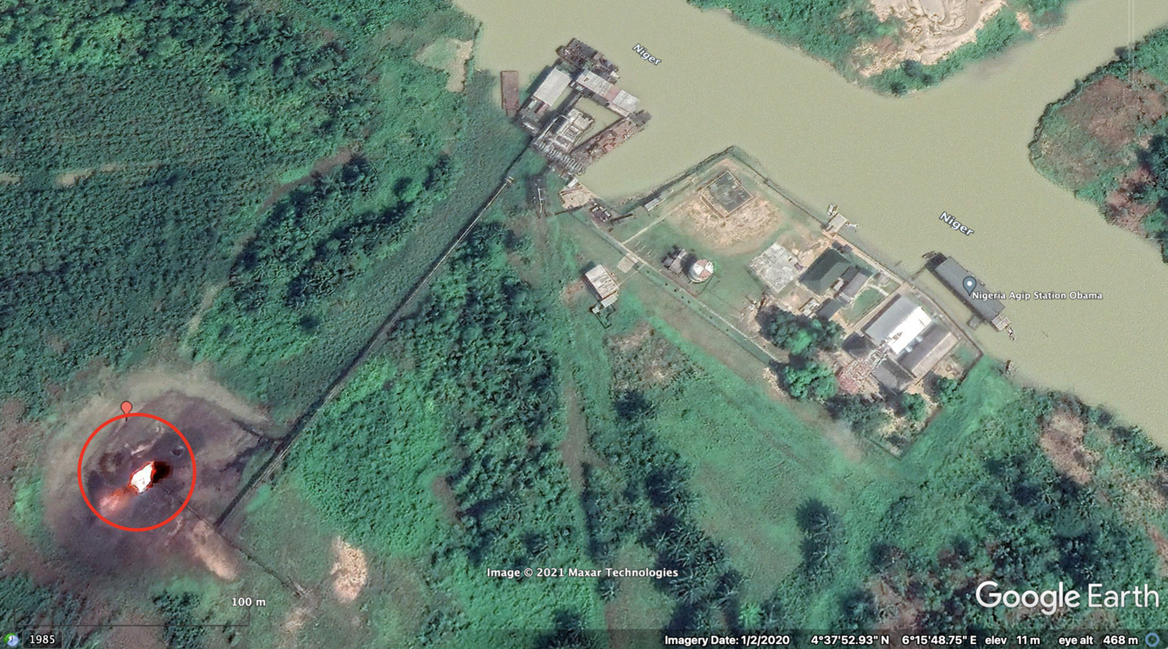
At current resolution, with efficient coding in publicly available software, FORMA should produce global updates on one desktop computer in a few hours. Maps of probable deforestation at 1 km resolution will be accessible with Google Earth and Google Maps, with an open facility for ground-truthing each pixel via photographs and text comments.
Preview
Topics
CITATION
Hammer, Dan, Robin Kraft, Ernesto Zedillo, and David Wheeler. 2009. FORMA: Forest Monitoring for Action--Rapid Identification of Pan-tropical Deforestation Using Moderate-Resolution Remotely Sensed Data - Working Paper 192. Center for Global Development.DISCLAIMER & PERMISSIONS
CGD's publications reflect the views of the authors, drawing on prior research and experience in their areas of expertise. CGD is a nonpartisan, independent organization and does not take institutional positions. You may use and disseminate CGD's publications under these conditions.